ShareThis

Showing posts with label Welsh Marilyns. Show all posts

Sunday, 25 September 2016

October 2016 The final Welsh Nuttalls

Walk Summary 
On 02 October 2008 I walked up Simon Fell, my very first English Nuttall.
That was before I even knew what a Nuttall was, let alone heard of Peak Bagging.
On that very same day I was looking beyond to the imposing mass of Ingleborough thinking "...this hill walking lark is OK, may look to do a bit more." Wondering if I would have the courage to tackle this monster in front and promising myself "...if I need a rope today or any other day I will not be going there".
Well that was at the beginning of this journey. Since then I have been up over 900 different hills all over Great Brtiain, even two in Iberia. I have learnt many new outdoor skills, travelled to places I have never been before, met many people along the way - and yes I have needed a rope and more importantly "gone there". Including ridge walking on the Isle of Skye, summitted Pillar Rock and even learnt Winter Mountaineering Skills roped up equipped with crampons and an Ice Axe. In essence it is my "Man on the Moon" project, by setting a goal that you have not done before, without the necessary skills, and refusal to not accept excuses for not achieving that goal what ever the reason.
On 06 November 2016; 8 years, 1 month and 4 days later I intend to walk up Arenig Fach the 444th and final English/Welsh Nuttall. It will of course not be my final hill because that is the beauty of this great outdoor pursuit. Not the ticking of summits off a list, but the access to new experiences and adventures introducing you to new interests such as geology, history, nature and fauna. All of which I know bugger all about but does not stop me asking questions and finding out answers. In fact I am finding these final few hills a pain since with so few left it is restricting me where I can actually go. But on the other hand it is providing a focus to complete something before going on to the next challenge. It will of course mark the end of this particular part of the journey. But what it has done is open up a world of experiences I never thought of having, would want to have, or be capable of achieving.
The next challenge?
Effectively my "Man on Mars" project to complete all of the GB Marilyns. All 1556 of them, including 202 of the 282 Munros (so I might as well do the lot) as well as the lesser known Corbetts and Grahams.
Not achieved by anyone until October 2014 first by Rob Woodhall then 1 hour later Eddie Dealty still only achieved by 10 people as of October 2016. The most recent being Rick Salter and the first lady Jenny Hatfield in September 2016.
My only regret is I cannot persuade my wife and soul mate to share in these new experiences and access to new interests. To me it is the elixir of life a reason to get up in the morning and something to look back on and say that is what has been done. It provides;- Purpose, Challenge, Adventure and Achievement.
Anyway before that there are 27 other Nuttalls including the recently added Calf Top in Cumbria necessitating a slight detour on the way to North Wales from Suffolk, which will now be my final English Nuttall instead of Pillar Rock which I eventually got round to climbing last June 2016.
Fail to plan and plan to fail - well that is not the plan. The overall objective is to complete all Nuttalls bar the final one , leaving time for recovery and hopefully a peak bagging day with fellow baggers on the Saturday before completion on Sunday 06 November.
A 25 Day plan to complete 15 walks leaving 10 days for rest days and travelling days. The bad weather days will of course coincide with these days as planned so you can reliably expect each walk as listed below to take place on the planned day below. NOT. But at least the plan demonstrates it is achievable without being too challenging.
(13 October2016 V4) 7 days into plan actual distance/ascent walk date included + proposed date of remaining walks
Yorkshire Dales
01-Calf Top
Starting from most convenient parking spot near Mill House have planned a clockwise route following the farm track to Calf Foot, ascending the Calf and bagging what will now be my third "Final English Nuttall, after Catstye Cam (NPR) in Aprl 2013 and Pillar Rock more recently in June 2016. Returning to Mill House after visiting what is now the isolated Dewey of Castle Knott.
I have planned this route as what I think will be easiest in terms of rate of ascent. However I intend to drive from Suffolk via Barbondale to check out the gradient and may be tempted to access from the steeper east side.
4.72 miles, 515.87m ascent, 3 hour 21 mins @ Av pace of 1.70mph  & + 1 hour/per 900m of ascent
Snowdonia
02-Gallt y Wenallt
Just a straight there and back walk from YHA Pen y Pass along the Miners Track to collect the summit I did not have time to do at the end of The Snowdon Horseshoe back in May 2016. 
5.92 miles, 624.15m ascent, 4 hour 07 mins @ Av pace of 1.70mph  & + 1 hour/per 900m of ascent
03-Yr Aran
Identifying Nantgwynant as the most convenient start point for a there and back walk to Yr Aran also alerted me to the possibility of access to Gallt y Wenallt. I will therefore check this out with a view to bagging both peaks as part of the same walk thereby saving a day and possibly a fiver by not having to park at Pen y Pass for planned walk start to Gallt y Wenallt.
5.56 miles, 762.28m ascent, 4 hour 02 mins @ Av pace of 1.70mph  & + 1 hour/per 900m of ascent
The Moelwyns
04-Moel Siabod
Yet another there and back walk this time starting from Moel Siabod Cafe Hoping to get an early start by taking advantage of parking there overnight the night before. will check this out with the Cafe.
5.60 miles, 724.27m ascent, 4 hour 02 mins @ Av pace of 1.70mph  & + 1 hour/per 900m of ascent
05-The Cnichts
A short circular route starting from Croesor in an anti-clockwise direction. Following the PROW up Cwm Croeor than the wall towards the north summit looks easier to navigate than up the ridge to the main Cnicht summit in a clockwise direction. Besides for some reason most of my routes are anti-clockwise, they just are.
4.20 miles, 583.66m, 3 hours 02 mins @ Av pace of 1.7mph  & + 1 hour/per 900m of ascent
06-The Manods & Moel Penamnen from Blaenau Ffestiniog
This looked like it may be easier to do as two short walks but as multi Nuttall walks are becoming few and far between have decided to start anti-clockwise from Blaenau Ffestiniog for both Manod Mawr summits then east and north round Graig-ddi slate quarry towards Moel Penamnen and the two nearby Deweys.
2.44 miles, 310.96m, 1 hour 53 mins @ Av pace of 1.75mph  & + 1 hour/per 600m of ascent
07-Moel Hebog
I admired these three summits from The Nantlle Ridge back in April 2016. It looks a splendid day out if the weather is good. This time in a clockwise direction from Beddgellert following what I hope is a well trodden and easily navigable path to the first and highest summit of Moel Hebog.
7.14 miles, 946.68m, 5 hours 09 mins @ Av pace of 1.7mph  & + 1 hour/per 900m of ascent

08-Five Nuttalls of the South Rhinogs
If the terrain lives up to its reputation and is anything like the ground I covered for the two northerly Rhinog peaks I reckon this will be one of the hardest walks of this trip and possibly of all the Welsh Nuttalls. There is a possibility I may be able to include Rhinog Fawr at the end of the walk after Rhinog Fach but with a planned duration of 8 hours 25 minutes I am not sure there will be enough daylight hours at this time of year, let alone energy left on my part.
11.91 miles, 1380.06m, 8 hours 26 mins @ Av pace of 1.7mph  & + 1 hour/per 900m of ascent
09-Rhinog Fawr
Not much chance of including this at the end of the South Rhinogs walk so expect to be doing this the day after that walk or two days if as I suspect is more likely a rest day is needed. This was a candidate to be my final Welsh Nuttall but because of the chance it could be part of another walk as well as not being sure of the route through the pine plantation I decided to go for an alternative summit.
5.49 miles, 489.64m, 3 hours 43 mins @ Av pace of 1.7mph  & + 1 hour/per 900m of ascent
10-Pen y Garn
For some reason I try to concoct circular walks or lassoo routes as I have coined and that has been my preference, where practcable throughout my Nuttall bagging journey. Hence as this route was planned some time ago we have a circular route for Pen y Garn. However I have spotted a closer start point near Bryn y Gwydd at the road junction with the Borth to Devil's Bridge to Ponthydfendigaid Trail. If there is adequate parking looks like it will be another there and backer.
7.04 miles, 388.39m, 4 hours 33 mins @ Av pace of 1.7mph  & + 1 hour/per 900m of ascent
11-Gorllwyn & Drygarn Fawr
A long hard day if what I am led to believe is over boggy ground. Had hoped to do this one during a hard winter when the ground was hard but I have had enough of those to have taken my chance so looks like I will have a boggy slog. Reckon the 10 miles in the planned 6½ hours could be a little longer.
12-North West Arans

7.14 miles, 946.68m, 5 hours 09 mins @ Av pace of 1.7mph  & + 1 hour/per 900m of ascent
13-Rhobell Fawr & Dduallt

2.44 miles, 310.96m, 1 hour 53 mins @ Av pace of 1.75mph  & + 1 hour/per 600m of ascent

14-Foel Goch and the four Deweys from Bala C&CC campsite

7.14 miles, 946.68m, 5 hours 09 mins @ Av pace of 1.7mph  & + 1 hour/per 900m of ascent

Thursday, 18 August 2016

North East Arans

Walk Summary
Esgeiriau Gwynion [Foel Rhudd] from Bwlch Sirddyn.
Easy enough navigation handrailing fences
to three of the days four Nuttalls
Not the route as planned due to not being able to find suitable parking anywhere along Cwm Croes between Talardd and Nant-y-Llyn. So a quick re-plan on the hoof heading back to Talardd and see if I can find a start point to the south.
Heading south towards Dinas Mawddwy, ascending to Bwlch y Groes and looking to my right it soon became obvious I could save myself a fair bit of ascent by starting from this side if I could find a parking spot. I should not have been surprised after all the pouring over maps, but was when I came across the the car park at Bwlch y Groes viewing point.
Starting from here meant there was only about 200m of ascent and easy navigation by following the fence to the first summit of Llechwedd Du. There was still the steep descent and slightly less steep re-ascent to Foel Hafod-fynydd but by then on this route over half the route had been walked.
Although not enjoying the bright sunshine of the weeks other two walks it was still clear enough to see a descent route down to Bwlch Sirddyn to again resume handrailing the fence to the summit of the days high point and Marilyn Esgeiriau Gwynion [Foel Rhudd].
At this point I was still intending to pick off the Dewey Llechwedd Llyfn but somehow the idea did not seem so appealing so I headed for the fourth and final Nuttall of the day Foel Rhudd.
Now I am back writing this up I am somewhat disappointed I did not pick up this isolated peak, but hey, I am not even doing the Deweys so why am I feeling frustrated I did not show a bit more resolve on the day. Probably because when I have finished the Nuttalls followed by the Munros, Corbetts, Grahams etc I will probably return to the Deweys. Who knows, well I do actually, I will be returning to this list when I want a break from north of the border and fancy a bit of hill walking closer to home.
Anyway that is for the future. For now I can see the van parked across the upper reaches of Cwm Cynllwyd but rather than heading down then up I will descending Foel Rhudd to the bwlch then contouring along the 580m contour on south side of Clipiau Duon more or less below the heather line and back to the van at Bwlch y Groes.
More or less the same distance walked on this improvised route but quite a lot less ascent. All in all a better route if you don't count not including Llechwedd Llyfn.

Walk Statistics
Walk Date - 18 August 2016
Walkers - Steve Smith

Accommodation - Bala Camping and Caravan Club Site
Start Point- Bwlch y Groes viewing point (SH 91301 23268)
Finish Point Bwlch y Groes viewing point (SH 91301 23268)
Total Duration - 3hrs 37mins 
Overall Average pace - 1.76mph
Total Distance Walked - 6.36 miles
Total Height Ascended - 524.88 metres


Peaks visited
Nuttalls (189W - 443E&W)
Llechwedd Du (159W - 413E&W)
Foel Hafod-fynydd (160W - 414E&W)
Esgeiriau Gwynion [Foel Rhudd] (161W - 415E&W)
Foel Rhudd (162W - 416E&W)
Hewitts (138W - 318E&W)
Llechwedd Du (111W - 290E&W)
Foel Hafod-fynydd (112W - 291E&W)
Esgeiriau Gwynion (113W - 292E&W)
Marilyns (158W - 1556E,W&S)
Esgeiriau Gwynion (91W - 258E,W&S)
Deweys (241E - 421E&W)
NONE
HuMPs (364E - 2975EW&S)
Esgeiriau Gwynion (107W - 341E,W&S)
Historic County Tops (413E - 93E,W&S)
NONE
W: Wales. 
E,W: England & Wales. 
E,W&S:England,Wales & Scotland

Other walks on this trip
2016
August
15th Central Arenigs
16th North Arenigs
18th North East Arans


Route
GPX can be downloaded from
More Photographs
First cairn on Foel Hafod-fynydd. Foel Hafod-fynydd summit on next hill towards Aran Fawddwy in cloud
Click on photograph to view slide-show

Tuesday, 16 August 2016

North Arenigs

Walk Summary
Easy navigation from
Carnedd y Filiast north to Waun Garnedd y Filiast
Straight forwards start following footpath along track for about 2 miles from A4212 to upper contours south of Foel-boeth. With the absence of a clear path decided to head directly uphill and leave track at point marked by a large boulder due south of summit through short cut heather.
No obvious path from Foel-boeth to Llechwedd-llyfn and a little confusion identifying summit due to only having a 6 figure grid reference which was obviously lower than summit candidates. There is a distinctive cairn near the fence but the summit is actually at the 643m spot height also marked by a cairn. There is also a couple of other high points north of the fence which I also visited just in case they become summit at a later date.
From here navigation is straight forward following the fence east to Carnedd y Filiast then north following another fence to the final summit of the day to Waun Garnedd-y-Filiast. Returning on the other side of the fence to give a semblance of a circular walk picking up the track which contours east of Carnedd y Filiast. 
I was seduced in to leaving the path to walk over Brottos summit, although it is not listed on DoBIH it has a spot height of 626m and a col spot height of 613m. Drop is 2m short of Nuttall status but felt compelled to visit it just in case it is ever measured and turns out to be a 15m drop. The ascent through heather was not too bad but the descent was probably the hardest part of the walk. Similar heather coverage as ascent but because it is steeper managed to obscure small drops which could easily cause a stumble if adequate care not taken.
Experience of this descent convinced me to stay on the track all the way back to the van rather than the planned direct route and another heather trot across Y Drum and Craig Lios.
Overall a straight forward walk on a lovely summers afternoon that could easily be tackled with an earlier start on a short winters day.


Walk Statistics
Walk Date - 16 August 2016
Walkers - Steve Smith

Accommodation - Bala Camping and Caravan Club Site
Start Point- Layby on Westbound side of A4212 (SH 85707 41042)
Start Time - 13:01
Finish Point - Layby on Westbound side of A4212 (SH 85707 41042)
Finish Time - 17:46

Total Duration - 4hrs 45mins 
Overall Average pace - 1.80mph
Total Distance Walked - 8.56 miles
Total Height Ascended - 563.43 metres


Peaks visited
Nuttalls (189W - 443E&W)
Carnedd Llechwedd-llyfn [Llechwedd-llyfn] (156W - 410E&W)
Carnedd y Filiast (157E - 411E&W)
Waun Garnedd-y-Filiast (158E - 412E&W)
Hewitts (138W - 318E&W)
Carnedd y Filiast (110W - 289E&W)
Marilyns (158W - 1556E,W&S)
Carnedd y Filiast (90W - 257E,W&S)
Deweys (241E - 421E&W)
Foel-boeth (52W - 107E&W)
HuMPs (364E - 2975EW&S)
Carnedd y Filiast (106W - 340E,W&S)
Historic County Tops (413E - 93E,W&S)
NONE
W: Wales.
E&W: England&Wales
E,W&S:England,Wales&Scotland

Other walks on this trip
2016
August
15th Central Arenigs
16th North Arenigs
18th North East Arans


Route
GPX can be downloaded from
More Photographs
Mynod Nodol from A4212 layby on north shore of Llyn Celyn
Click on photograph to view slide-show

Monday, 15 August 2016

Central Arenigs

Walk Summary
Originally planned as two separate walks on two separate short winter days.
In spite of the late start was able to take advantage of the long summer days and amalgamate the two walks in to one.
Hard day for first walk of the trip but guess I am retaining my hill legs due to the regular trips I am managing this year.
Turned out to be a 6 Nuttall day which will be the most Nuttalls I will manage in a single day before completion of the list later this year.
Fairly straight forward route but two things I would do differently.
  • During ascent of Moel Llyfnant make sure you keep to the left rather than heading for numerous false summits. I managed this most of the time but was seduced on the very last one.
  • On descent from Moel llyfnant stay with fence down Llechwydd Rudd and north of plantation to give yourself the chance to bag the sub-Dewey Moel y Slates.
Hendre-blaen-Lliw was under reconstruction so I ended up walking round the back hopefully signposting will be improved to confirm path goes in front of building

Walk Statistics
Walk Date - 15 August 2016
Walkers - Steve Smith

Accommodation - Bala Camping and Caravan Club Site
Start Point- Grass verge heading west just past Hendre-blaen-Lliw (SH 80477 33553)
Start Time - 11:52Finish Point - Grass verge heading west just past Hendre-blaen-Lliw (SH 80477 33553)
Finish Time - 18:57

Total Duration - 5hrs 24mins 
Overall Average pace - 1.43mph
Total Distance Walked - 11.16 miles
Total Height Ascended - 985.40 metres

Peaks visited
Nuttalls (189W - 443E&W)
Arenig Fawr South Ridge Top (150W - 404E&W)
Arenig Fawr South Top (151E - 405E&W)
Arenig Fawr (152E - 406E&W)
Moel Llyfnant (153E - 407E&W)
Gallt y Daren (154E - 408&W)
Foel Boeth (155E - 409E&W)
Hewitts (138W - 318E&W)
Arenig Fawr (107W - 286E&W)
Moel Llyfnant (108W - 287E&W)
Gallt y Daren (109W - 288E&W)
Marilyns (158W - 1556E,W&S)
Arenig Fawr (88W - 255E,W&S)
Moel Llyfnant (89W - 256E,W&S)
Deweys (241E - 421E&W)
Moel y Wden [Bwlch y Bi] (51W - 106E&W)
HuMPs (364E - 2975EW&S)
Arenig Fawr (103W - 337E,W&S)
Moel Llyfnant (104W - 338E,W&S)
Gallt y Daren (105W - 339E,W&S)
Historic County Tops (413E - 93E,W&S)
NONE
E&W: Wales. 
E,W&S:England,Wales & Scotland
Other walks on this trip
2016
August
15th Central Arenigs
16th North Arenigs
18th North East Arans
Route
GPX can be downloaded from
More Photographs
Steep ascent up Allt -fawr on far side of Llyn Iwerddon
Click on photograph to view slide-show

Thursday, 26 May 2016

The Ysgafell Wens, Moel Druman & Allt-Fawr [Allt Fawr]

Walk Statistics
Walk Date - 26 May 2016
Walkers - Steve Smith

Accommodation - Coed-Y-Llwyn Caravan Club Site
Start Point- Abandoned road off the A470 just north of Tal-y-waenydd (SH 69918 48507)
Finish Point Abandoned road off the A470 just north of Tal-y-waenydd (SH 69918 48507)
Total Duration - 3hrs 54mins 
Overall Average pace - 1.65mph
Total Distance Walked - 6.43 miles
Total Height Ascended - 603.43 metres


Peaks visited
Nuttalls (189W - 443E&W)
Allt-Fawr [Allt Fawr] (145W - 398E&W)
Moel Druman (146W - 399E&W)
Ysgafell Wen (147W - 400E&W)
Ysgafell Wen North Top (148W - 401E&W)
Ysgafell Wen Far North Top (149W - 402E&W)
Hewitts (138W - 317E&W)
Allt-Fawr [Allt Fawr] (103W - 282E&W)
Moel Druman (104W - 283E&W)
Ysgafell Wen (105W - 284E&W)
Ysgafell Wen North Top (106W - 285E&W)
Marilyns (175E - 1556E,W&S)
Allt-Fawr [Allt Fawr] (86W - 248E,W&S)
Deweys (181E - 422E&W)
NONE
HuMPs (444E - 2975EW&S)
Allt-Fawr [Allt Fawr] (101W - 330E,W&S)
Historic County Tops (49E - 93E,W&S)
NONE
W: Wales. 
E,W&S:England,Wales & Scotland

Other walks on this trip
2016
May
21st Foel Penolau & Moel Ysgyfarnogod
23rd Snowdon Horseshoe
25th Moelwyns Mawr & Bach and two other nearby Nuttalls from Tanygrisiau
26th The Ysgafell Wens, Moel Druman & Allt-Fawr from Tal-y-waenydd


Route
GPX can be downloaded from
More Photographs
Steep ascent up Allt -fawr on far side of Llyn Iwerddon
Click on photograph to view slide-show

Wednesday, 25 May 2016

Moelwyns Mawr & Bach and two other nearby Nuttalls from Tanygrisiau

Walk Statistics
Walk Date - 25 May 2016
Walkers - Steve Smith

Accommodation - Coed-Y-Llwyn Caravan Club Site
Start Point- Tanygrisiau car park to south of bridge over of Llyn Cwmorthin outfall (SH 68319 45196)
Finish Point Tanygrisiau car park to south of bridge over of Llyn Cwmorthin outfall (SH 68319 45196)
Total Duration - 4hrs 14mins 
Overall Average pace - 1.51mph
Total Distance Walked - 6.39 miles
Total Height Ascended - 807.26 metres


Peaks visited
Nuttalls (189W - 443E&W)
Moel-yr-hydd (141W - 394E&W)
Moelwyn Mawr (142W - 395E&W)
Craigysgafn (143W - 396E&W)
Moelwyn Bach (144W - 397E&W)
Hewitts (138W - 317E&W)
Moel-yr-hydd (100W - 279E&W)
Moelwyn Mawr (101W - 280E&W)
Moelwyn Bach (102W - 281E&W)
Marilyns (175E - 1556E,W&S)
Moelwyn Mawr (85W - 247E,W&S)
Deweys (181E - 422E&W)
NONE
HuMPs (444E - 2975EW&S)
Moelwyn Mawr (99W - 328E,W&S)
Moelwyn Bach (100W - 329E,W&S)
Historic County Tops (49E - 93E,W&S)
NONE
W: Wales. 
E,W&S:England,Wales & Scotland

Other walks on this trip
2016
May
21st Foel Penolau & Moel Ysgyfarnogod
23rd Snowdon Horseshoe
25th Moelwyns Mawr & Bach and two other nearby Nuttalls from Tanygrisiau
26th The Ysgafell Wens, Moel Druman & Allt-Fawr from Tal-y-waenydd


Route
GPX can be downloaded from
More Photographs
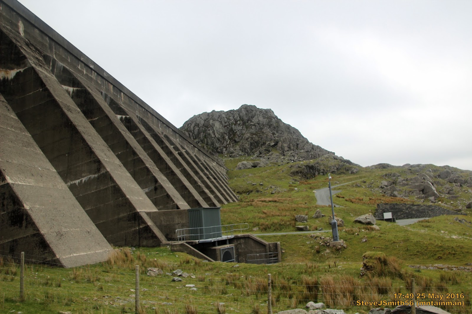
Final peak of the day, bonus sub-Dewey Craig Stwlan from bottom of SW end of Stwlan dam
Click on photograph to view slide-show

Monday, 23 May 2016

Snowdon Horseshoe

Walk Summary
Arguably one of the most iconic Nuttall walks you are ever likely to undertake.
Craig Fach first summit of the day towards The Glyders.
At 608.75 misses out on Nuttall status by 830mm
64 photos (more than I usually like to include) but really could have done with more to give a full photo commentary of the route.
The other way is to watch a video of the full 5½ hour walk or better still acquire the skills, gain the confidence and take the care to do it yourself.
Many descriptions online tend to over big the route emphasising horrendous weather conditions and extreme jeopardy, resulting in me putting off this walk, waiting for perfect weather and a sense of anxiety leading up to and during the walk.
In some ways not a bad thing. You do need to be fully capable to attempt this route in any, even perfect conditions, but if you have the necessary skills making sure you have the equipment appropriate to the conditions, as well as knowing how to use it; all you have to do is take care and ENJOY.
Not a lot more to say about the route other than there is far more scrambling than I have ever done alone in any one route. A long way from my first hill on Simon Fell when I distinctly remember thinkin "... this hill climbing seems OK, but if there is ever a time when I need a rope I will not be going there".

Well I think scrambling was included in that maxim. Just goes to show unless you take that first step on a journey, you have no idea where you might turn up"
One final point worth mentioning is that the car park at Pen y Pass charges £10 for the full day, £5 for up to four hours. Quite a lot thinks I, but the car park was full by 11pm on a Monday morning so if the money goes to the National Park not a bad way of rationing parking spaces while at the same time contributing to a good cause. I am sure the record for The Snowdon Horseshoe is significantly below four hours, so for us mortals if you do not want to pay £10 you can use the S2 service from Llanberis at a cost of £1.50 each way.
Make sure you leave enough time to complete the whole circuit. I was sat in Snowdon cafe at 4:00pm, having a cup of coffee when I remembered the last bus back to Llanberis was 7:05pm. enough time to return over the Lliwedd Nuttalls but would there be enough time to nip over to Gallt y Wenallt?
Even where the path diverged back to Pen y Pass on the descent from Lliwedd Bach I was tempted to head west for the final Nuttall, However arriving back at the bus stop 18:55pm confirmed the made correct choice was made.
In terms of costs I am still in pocket. Yes it will still cost me another £3 in bus fare, but I will be returning to the area for Moel Siabod anyway.

Walk Statistics
Walk Date -23 May 2016
Walkers - Steve Smith

Accommodation - Coed-y-Llwyn Caravan Club Site
Start Point-   Bus Stop opposite YHA Pen-y-Pass (SH 64744 55610)
Finish Point Bus Stop opposite YHA Pen-y-Pass (SH 64744 55610)
Total Duration - 5hrs 24mins 
Overall Average pace - 1.43mph
Total Distance Walked - 7.74 miles
Total Height Ascended - 1295.94 metres


Peaks visited
Nuttalls (189W - 443E&W)
Crib Goch (135W - 388E &W)
Crib y Ddysgl (136W - 389E &W)
Snowdon - Yr Wyddfa (137W - 390E &W)
Lliwedd (138W - 391E &W)
Lliwedd East Top (139W - 392E &W)
Lliwedd Bach (140W - 393E &W)
Hewitts (138W - 317E&W)
Crib Goch (96W - 275E &W)
Crib y Ddysgl (97W - 276E &W)
Snowdon - Yr Wyddfa (98W - 277E &W)
Lliwedd  (99W - 278E &W)
Marilyns (158W - 1556E,W&S)
Snowdon - Yr Wyddfa (83W - 245E,W &S)
Lliwedd (84W - 246E,W &S)
Deweys (241W - 422E&W)
Craig Fach (49W - 102E &W)
HuMPs (366W - 2975E,W&S)
Snowdon - Yr Wyddfa (97W - 326E,W &S)
Lliwedd  (98W - 327E,W &S)
Historic County Tops (13W - 93E,W&S)
Snowdon - Yr Wyddfa (9W - 53E,W &S)
W: Wales. 
E,W&S:England,Wales & Scotland

Other walks on this trip
2016
May
21st Foel Penolau & Moel Ysgyfarnogod
23rd Snowdon Horseshoe
25th Moelwyns Mawr & Bach and two other nearby Nuttalls from Tanygrisiau
26th The Ysgafell Wens, Moel Druman & Allt-Fawr from Tal-y-waenydd


Route
OS 1:25,000 route map to follow.
GPX can be downloaded from www.shareyouradventure.com

More Photographs
Descent route down Crib Goch. Like all mountains the job is only half done at the summit
Click on photograph to view slide-show

Saturday, 21 May 2016

Foel Penolau & Moel Ysgyfarnogod

Walk summary
Had not intended to venture in to the Rhinogs on this trip but an extremely wet morning around Ffestiniog persuaded me to ditch plans for a longer walk in to the Moelwyns, so planned this half day walk for later in the afternoon. 
No suitable parking near Cefn Clawdd
Rain had stopped but still cloudy on summits limiting visibility. As well as the two planned Nuttalls; managed three Deweys, plus two sub Deweys. 
Only 6.6 miles and surprising small amount of ascent at 495m, but felt very tired when finished after 4½ hours at 7:15pm. 
Due maybe to first strenuous exercise for nearly one month or was it because of lots of down scrambling and later up scrambling.
Physically prepared or not with good or bad visibility expect some rough terrain and lots for alternatives for high points on many of the summits.

Walk Statistics
Walk Date -21 May 2016
Walkers - Steve Smith

Accommodation - Coed-y-Llwyn Caravan Club Site
Start Point-   Quarry spoil heap on left of road to Cefn Clawdd (SH 68357 33613)
Finish Point Quarry spoil heap on left of road to Cefn Clawdd (SH 68357 33613)
Total Duration - 4hrs 32mins 
Overall Average pace - 1.46mph
Total Distance Walked - 6.64 miles
Total Height Ascended - 495.13 metres


Peaks visited
Nuttalls (189W - 443E&W)
Foel Penolau (133W - 386E &W)
Moel Ysgyfarnogod (134W - 387E &W)
Hewitts (138W - 317E&W)
Moel Ysgyfarnogod (95W - 274E &W)
Marilyns (158W - 1556E,W&S)
Moel Ysgyfarnogod (82W - 244E,W &S)
Deweys (241W - 422E&W)
Moel y Gyrafolen (46W - 99E &W)
Craig Ddrwg (47W - 100E &W)
Clip (48W - 101E &W)
HuMPs (366E - 2975E,W&S)
Moel Ysgyfarnogod (96W - 325E,W &S)
Historic County Tops (49E - 93E,W&S)
NONE
W: Wales. 
E,W&S:England,Wales & Scotland

Other walks on this trip
2016
May
21st Foel Penolau & Moel Ysgyfarnogod
23rd Snowdon Horseshoe
25th Moelwyns Mawr & Bach and two other nearby Nuttalls from Tanygrisiau
26th The Ysgafell Wens, Moel Druman & Allt-Fawr from Tal-y-waenydd


Route
OS 1:25,000 route map to follow.
GPX can be downloaded from www.shareyouradventure.com

More Photographs
Looking back at what you would go over if you took a SW bearing off Foel Penolau alternate SW summit.
Click on photograph to view slide-show