
Walk summary
 |
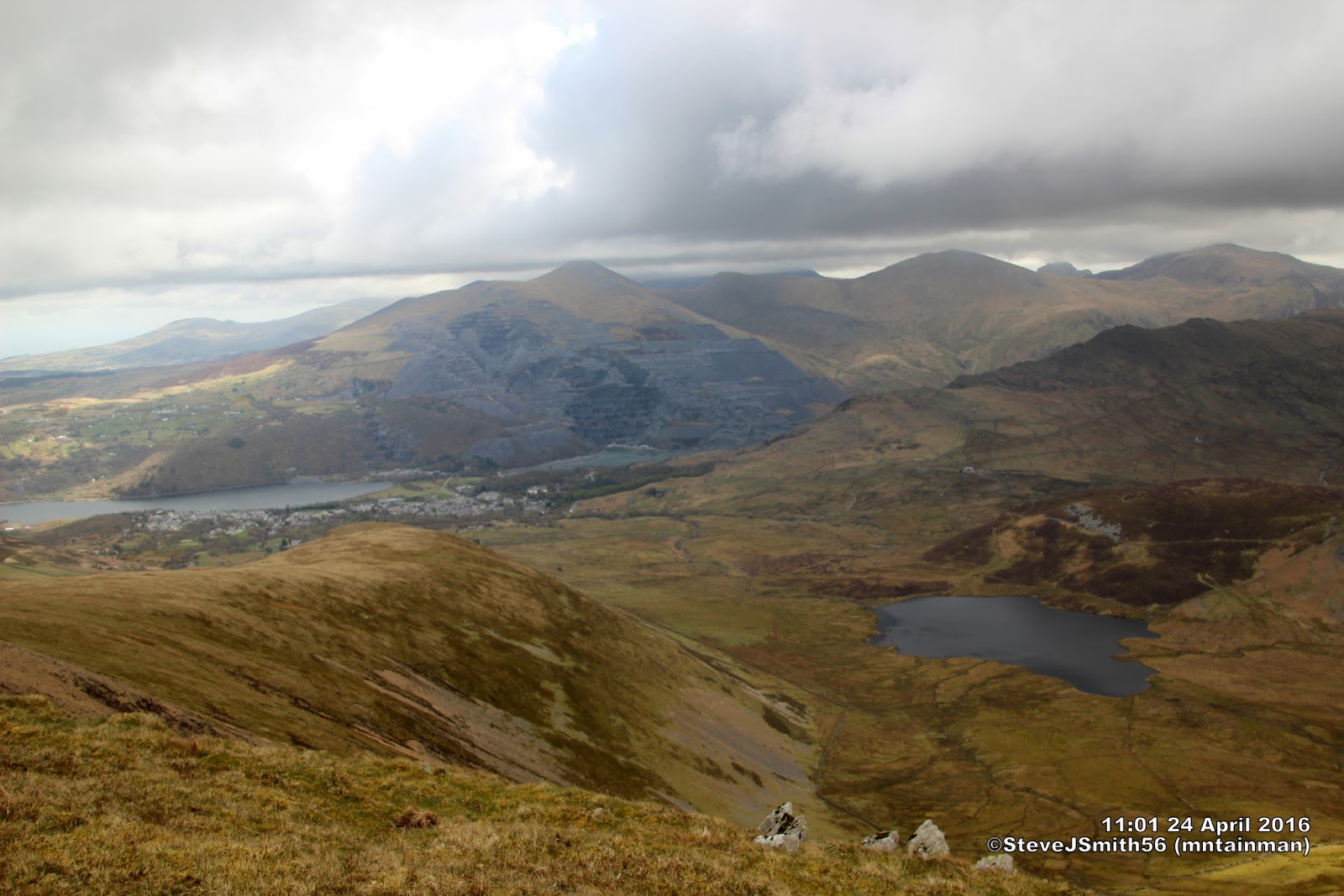
| Moel Cynghorion summit on other side of stile. The P600 summits of Y Garn and Elidir Fawr beyond |
The plan allowed for 1200m of ascent as long as I could find a route down Maen-d’ur Arddu from Bwlch Cwm Brwynog. There is no marked path on the map and a potentially craggy area below a fence that terminates just above the crag. Although I expected to find a route, it did not become clear until I was well down Moel Cynghorion.
Having found the route down Maen-d’ur Arddu I fully expected the walk to go as planned. However after reaching Llechog rather than descend down to the Llanberis path I stayed high returning to Llanberis along the ridge over Tryfan (not the famous one) and on to Derlwyn both of which do not have an entry on www.hill-bagging.co.uk but which from Llechog looked like they had some potential.
644m spot height
Since contours on map can be regarded as accurate I assume spot heights can enjoy the same status. So the 631m spot height at col with Llechog suggests a drop of only 13m, missing Nuttall status by 2m. My Anquet tracklog recorded summit as 650m and 631m spot height as 637m still a drop of 13m and insufficient to claim Nuttall status for the 644m spot height (Llechog NE Top?)
Tryfan
With such an iconic name I would have expected this to have status as a recognised peak. No spot height on map but my Anquet tracklog recorded it at 601m unfortunately Col between Tryfan and 644m spot height at (SH 59973 57640) was recorded as 582m missing out on sub-Dewey status. Also no 600m contour but I suspect Anquet heights measure on the high side.
Derlwyn
I found 3 candidates for the high point within the 410m contour the highest of which was measured as 420m by the Anquet tracklog. Unfortunately the col at SH 59038 58498 is only 420m so misses out on 400m TUMP status
Walk Statistics
Walk Date -24 April 2016
Walkers - Steve Smith
Accommodation - YHA Snowdon Llanberis
Start Point- YHA Snowdon Llanberis (SH 57410 59705)
Finish Point - YHA Snowdon Llanberis (SH 57410 59705)
Total Duration - 6hrs 51mins
Overall Average pace - 1.57mph
Total Distance Walked - 10.74 miles
Total Height Ascended - 1379.69 metres
Peaks visited
Nuttalls (189W - 443E&W)
Moel Eilio (122W - 375E &W)
Foel Gron (123W - 376E &W)
Moel Cynghorion (124W - 377E &W)
Llechog (125W - 378E &W)
Hewitts (138W - 317E&W)
Moel Eilio (88W - 267E &W)
Foel Gron (89W - 268E &W)
Moel Cynghorion (90W - 269E &W)
Marilyns (175E - 1556E,W&S)
Moel Eilio (78W - 240E,W &S)
Moel Cynghorion (79W - 241E,W &S)
Deweys (181E - 422E&W)
Foel Goch (45W - 98E&W)
HuMPs (444E - 2975EW&S)
Moel Eilio (92W - 321E,W&S)
Moel Cynghorion (73W - 322E,W&S)
Historic County Tops (49E - 93E,W&S)
NONE
Moel Cynghorion (73W - 322E,W&S)
Historic County Tops (49E - 93E,W&S)
NONE
W: Wales.
E,W&S:England,Wales & ScotlandOther walks on this trip
2016
April
21st Y Garn to Carnedd y Filiast ridge
22nd Y Foel Goch & Gallt yr Ogof
23rd Mynydd Mawr
24th Moels Eilio & Cynghorion, Foel Gron and Llechog from YHA Llanberis
26th Nantlle Ridge
OS 1:25,000 route map to follow.
GPX can be downloaded from www.shareyouradventure.com
 |
The north east end of Nantlle Ridge from cairn SE of Mynydd Mawr summit
Click on photograph to view slide-show
|